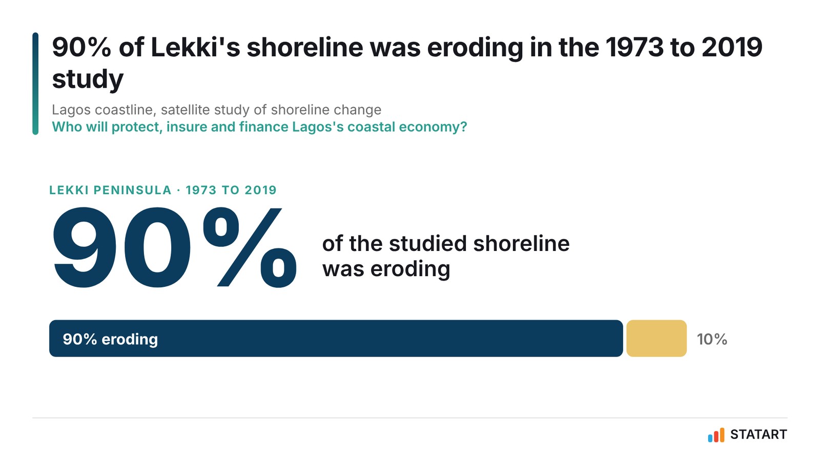
90% of Lekki's shoreline retreated an average 3.55m a year. Who will protect Lagos's coastal economy?
On World Tsunami Awareness Day, STATART looks at Nigeria's documented coastal risks: a peer-reviewed study found erosion along 90% of Lekki's shoreline from 1973 to 2019, surges that have killed, and insurance premiums equal to 0.5% of GDP.

World Tsunami Awareness Day | 5 November 2026
In December 2015 the UN General Assembly named 5 November World Tsunami Awareness Day. The reason is in the numbers: about 58 tsunamis have killed more than 260,000 people in the past 100 years, and the 2004 Indian Ocean tsunami alone killed about 227,000 people in 14 countries, according to UN figures.
Nigeria's coast faces a different threat. The World Bank-supported ThinkHazard platform classifies tsunami hazard in Lagos State as low. In its Lagos State assessment as published in November 2026, it rates coastal flooding as medium and river and urban flooding as high. The distinction matters: tsunami risk is not the same as the coastal erosion, storm surges and flooding already affecting Lagos.
How the sea took the shoreline, 1973 to 2019
A 2022 peer-reviewed study of 180km of the Lagos coast, using satellite images from 1973 to 2019, measured how fast the shoreline moved over those 46 years. On the Lekki Peninsula, 90% of the shoreline was eroding, at an average of 3.55m a year. In the section now occupied by Eko Atlantic, 92% was eroding at 3.59m a year between 1973 and 2008, before reclamation began. Even the most stable section, marginal Lagos, lost ground on 77% of its length at 1.73m a year. These are average rates for the eroding stretches over the study period. They do not describe every location, or conditions in 2026, after reclamation and coastal works changed parts of the shore.
Source: Osanyintuyi, Wang and Mokhtar, Journal of African Earth Sciences, 2022, from Landsat imagery. Historical average rates for eroding stretches, not coastline-wide averages or current 2026 rates. Share of each section eroding: Eko Atlantic 92%, Lekki 90%, Marginal Lagos 77%. Eko Atlantic shown before its 2008 reclamation works. Chart: STATART Insights and Analytics
See the numbers
| Retreat | |
|---|---|
| Eko Atlantic section, 1973 to 2008 | 3.59m |
| Lekki Peninsula, 1973 to 2019 | 3.55m |
| Marginal Lagos, 1973 to 2019 | 1.73m |
The study's peak rate was 12.81m a year on the Lekki Peninsula between 1973 and 1986. It names sea-level rise, reduced sand supply from dammed rivers, hard coastal engineering and population pressure as drivers.
The sea can also arrive suddenly. In August 2012 an Atlantic surge at Kuramo Beach in Victoria Island destroyed shacks and killed 16 people.
Lagos has started to build defences
The 8.5km sea revetment at Eko Atlantic, known as the Great Wall of Lagos, now shields Victoria Island and Eko Atlantic from erosion and storm surges. In June 2026, Lagos Environment Commissioner Tokunbo Wahab said the wall should be extended alongside the Lagos-Calabar Coastal Highway, reports show. That is the commissioner's position, not an approved or funded project.
The federal government's 2026 Annual Flood Outlook lists Lagos among the high-risk states. It places 14,118 communities in 266 local government areas at high flood risk, and warns that Bayelsa, Cross River, Delta, Lagos, Ogun, Ondo and Rivers face flooding from rising sea levels and tidal surges.
Nigeria knows what a bad flood year costs. In 2022, floods killed 662 people and displaced 2,430,445, the National Emergency Management Agency reported.
Insurance reaches a small part of the economy
Insurance premiums equal about 0.5% of Nigeria's GDP, according to the insurance regulator's programme in September 2026. The NAICOM-backed Insurance Sector Strengthening Programme aims to raise that to 10% by 2031, an ambition, not a forecast. A separate measure puts the share of Nigerians with any insurance cover at about 5%. Neither figure shows how much coastal property in Lagos is insured. That share is not published. The industry wrote N2.30tn in gross premiums in 2025, up 47.3%, and fire insurance made up 20.4% of non-life premiums (TVC News).
Source: Insurance Sector Strengthening Programme, backed by NAICOM, September 2026. The 10% is a programme ambition, not a forecast. Premiums as % of GDP differ from the share of Nigerians insured, about 5%, and from the unpublished share of coastal property insured. Chart: STATART Insights and Analytics
See the numbers
| Penetration | |
|---|---|
| Reported baseline | 0.5% |
| ISSP ambition, 2031 | 10.0% |
The gap between documented coastal risk and limited insurance reach is the market story of this day.
What this day means for Nigeria
World Tsunami Awareness Day asks countries to prepare for rare, catastrophic waves. Nigeria's version of that question is slower and closer to home: a shoreline that eroded along most of its length over 5 decades of study, surges that can kill, and an insurance market that reaches a small part of the economy. Preparing for the sea in Lagos means measuring the risk, financing the defences and pricing the cover.
Sources: World Tsunami Awareness Day · ThinkHazard, Lagos · Osanyintuyi, Wang and Mokhtar, Journal of African Earth Sciences, 2022 · Kuramo Beach · Eko Atlantic facts · Great Wall of Lagos · 2026 Annual Flood Outlook · NEMA via The Star, 2022 floods · NAICOM penetration target · TVC News, NAICOM Q4 2025